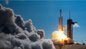
Search engine giant Google is supporting a mission aimed at tracing methane in space, which is scheduled to launch in March and tap the presence of methane levels around the world. The satellite designed for the project will revolve 15 times a day around while orbiting at 300 miles about the Earth.
Why Google is mapping methane in space
Since it stores heat, scientists believe that Methane has a significant contribution in worsening global warming. Although huge amount of Methane comes out of farming and waste disposal, methane produced by oil and gas plants will be the primarily focus of the project.
Google, for the new project, is collaborating with the Environmental Defense Fund, a non-profit global climate group. Google's role in the project will be to refine the data — utilising the capabilities of its AI tools — collected by satellite to construct a methane map to pinpoint methane leaks marked on the oil and gas infrastructure around the world.
Read more: WATCH: Spectacular thunderstorm seen from International Space Station
However, the firm says if it comes across a significant leak, it would not notify the company that owns the infrastructure responsible for it.
"Our job is to make information available," it said, adding that governments and regulators would be among those with access to it and it would be for them to force any changes."
There are no international regulations for controlling methane emissions. The EU has approved a set of measures aimed at reducing emissions, including requiring oil and gas operators to fix leaks.
Google's map, to be released on its Earth Engine, will not provide real-time data, as information will be transmitted from the satellite every few weeks. In 2017, the European Space Agency launched a similar satellite instrument called Tropomi, which monitors the presence of trace gases in the atmosphere, such as methane. It was a mission with a minimum seven-year life span, which means it could end this year.
The Carbon Mapper report, utilising Tropomi data, was published in 2022 and revealed that the largest methane emissions were observed in Turkmenistan, Russia, and the US. However, due to cloud cover, the data did not include Canada or China.
Google expressed its aspiration for its project to bridge the gaps in current tools. According to NASA, methane levels have increased by over 100% in the past two centuries, with 60% of it being generated by human activities, primarily from livestock, especially cows.
The US Environmental Protection Agency released a report in 2020 stating that one cow has the potential to generate 154-264 pounds of methane gas annually. The report also mentioned that an estimated 1.5 billion cows are being raised globally for their meat production.
"Satellites are great for finding the really big, massive culprits" of methane emissions, said Peter Thorne, professor of physical geography at Maynooth University in Ireland.


